August 29th, 2020: Whistler Interpretive Forest to Whistler Mountain
- Elaine
- Aug 29, 2020
- 5 min read
Updated: Sep 26, 2022
Type of hike: One way (take the gondola back down)
Time (approx): 5 hours 35 mins
Distance: Around 18.6km
Hello, and welcome to my Whistler Interpretive Forest adventure!
The Hike
This trail starts from Whistler Olympic Village near Cheakamus Farside Loop and goes through Whistler Interpretive Forest all the way to the top of Whistler mountain. The elevation gain is about 1000m. While I did see a path, it was for the most part poorly maintained, and I saw a few bike tracks in the mud, which is why I am certain this trail is actually meant for mountain biking. I also saw a a few mountain bikers and no other hikers at all.
I would only attempt this if you are someone who is experienced in using your instincts to follow trails. There are some ribbons tied to tree trunks but those are very far apart. In other words, you could get lost in this massive forest and there would be no signs pointing the way out. If you have a trail map, that is going to be your best friend. This forest is part of Garibaldi Provincial Park, which means Whistler does not patrol it so it would be best to not get lost in it...

I started from the Farside Loop trailhead and walked along Cheakamus River for a bit. The force of the water flowing is powerful and reminded me a little bit of Niagara Falls.
Farside connects to Highside, and from there I trekked through some switchbacks that were fairly steep. Not a lot of loose rocks but lots of tree branches and dry mud. A good pair of hiking boots to grip the ground is necessary.

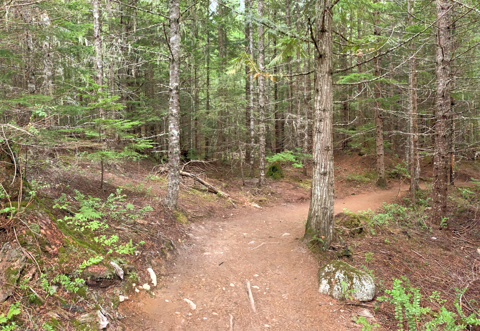


For a good 6km all there was to see were tree trunks, green leaves and occasionally berries. Surprisingly, I enjoyed the walk as I was listening to an audio book at the same time. It felt very meditative because I was all alone and surrounded by nature.
The brown landscape slowly changed to a very lush green blanket of various different kinds of plants:
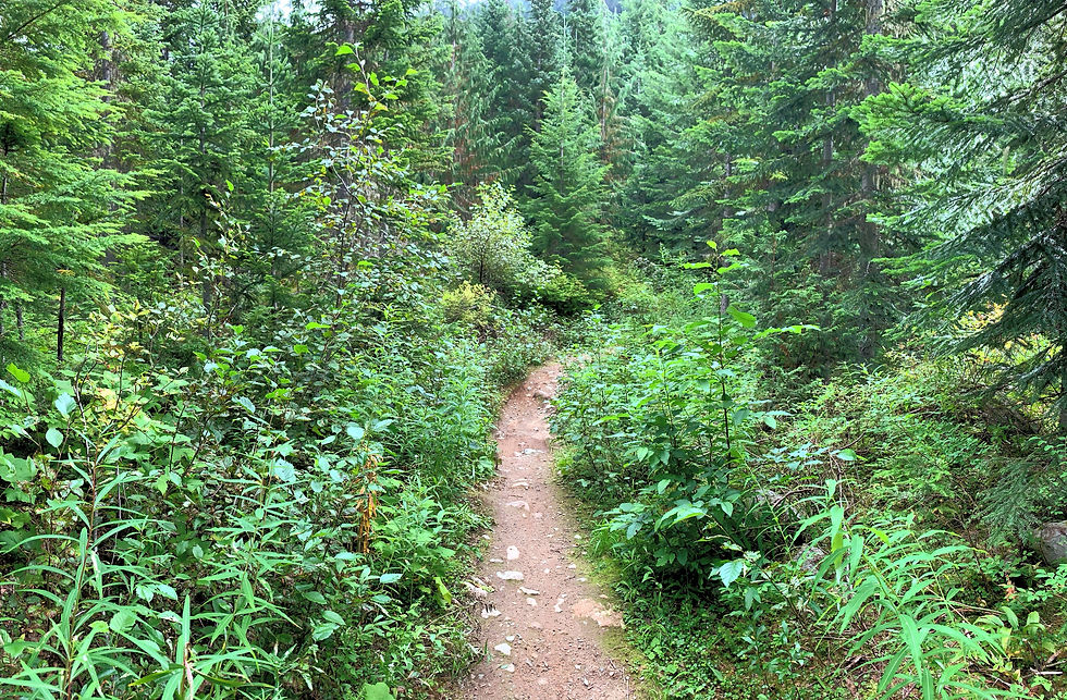
Around 6.5km the view changed to this:

This section did not last long. At around 7km, I basically dived straight into the thickets of the forest. It was very similar to the green landscape photo I showed above, except this time, for about 1km, the trees/plants were so overgrown and unmaintained that if there was originally a path somewhere, it was now either covered or nonexistent. I walked straight into countless spider webs and had flies swarm all over, but I continued anyways (feeling half-blind because I literally could not see anything but leaves).
I remember wondering if AllTrails was playing a trick on me because there was no way anybody would consider this an actual trail. So it came as a bit of a relief to see wooden planks on the ground here and there, reminding me at least ONE person came here before.

Some of the planks were big and wide, some were very narrow and unstable. I only used them to cross over large patches of mud. I believe this part of the 'trail' is called See Colours And Puke, as unbelievable as it sounds. Lots of incredible steep switchbacks up until 8.8km, and in some areas I really had to get on all fours to crawl up. That was when I knew this was really meant for mountain biking and not for hiking at all. Even though the thickets started to dissipate, the path was not marked and I wandered off the trail shown on the app a few times. You just simply have to keep the app open at all times.
This was taken at about 8.8km. It was an incredible view of the forest I had just fought my way through:
I got onto Upper Babylon after See Colours And Puke, and this section was relief for my tired legs. The incline was more gradual and I used the time to catch my breath. Around 9.5km I saw the BC Microwave Tower:

There was also an open dirt road for service vehicles and I remember feeling so relieved to see signs of civilization. This must be how our ancient ancestors felt when they lived in the forest, except they probably ran if they saw signs of another tribe.
Back into the forest I went at 10km. This section is called Khyber Pass and it connects to Top of the World Trail (near the top of Whistler Mountain). This section was easy in comparison to what I just went through. It meanders through lots of trees, plants and large patches of moss. It was not as dense and it felt nice to finally feel the sun on my skin.


(At one point, I even got to see the mountain skyline)
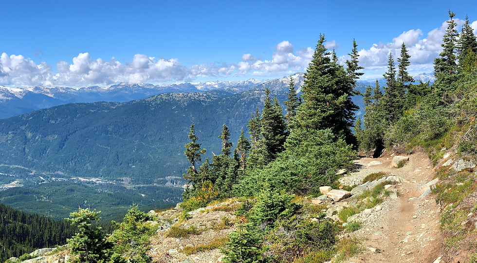
Top of the World trail circles all around Whistler Mountain and connects to various other trails like Highway 86. My destination is the Roundhouse Lodge so I can take the gondola back down, so I took a right at the junction where Khyber connects of Top of the World. Familiar sights of loose rocks and gravel indicated to me I had finally left the interpretative forest behind.
No wonder they named this Top of the World:


There are lots of trails leading to various places so it is best to use the map to guide you to wherever your destination is. You can actually connect to the High Note Trail if you want (or are still able to).
Since the app is not very up to date with which trails are open or closed due to new Covid restrictions, I accidentally went on one where I realized later on that it was not allowed for hiking (I saw the sign afterwards because the signs were actually meant for people starting from Whistler mountain, not the interpretive forest). Belatedly, I now understand why it was not allowed - the incline was sharp and the ground was full of loose rocks. I was sliding with every step. If it were not for my shoes, I doubt I would have been able to make it.
Luckily, I soon found my way back on the Mathews Traverse and from there on it was easy route to the Lodge. After climbing up 1000m, it was a relief to go downhill.
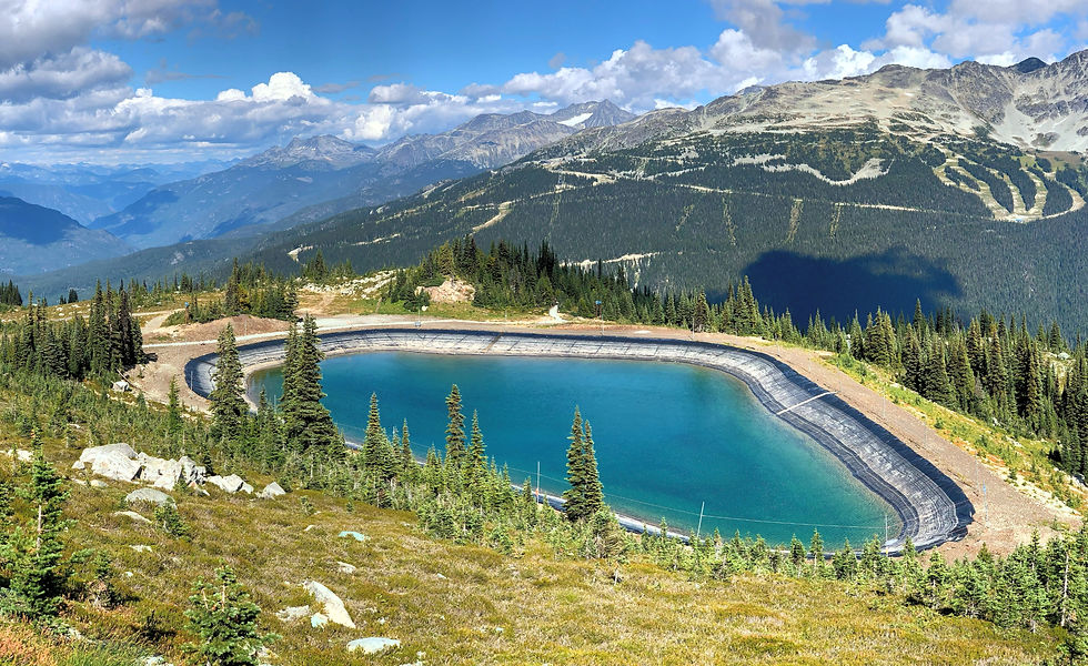
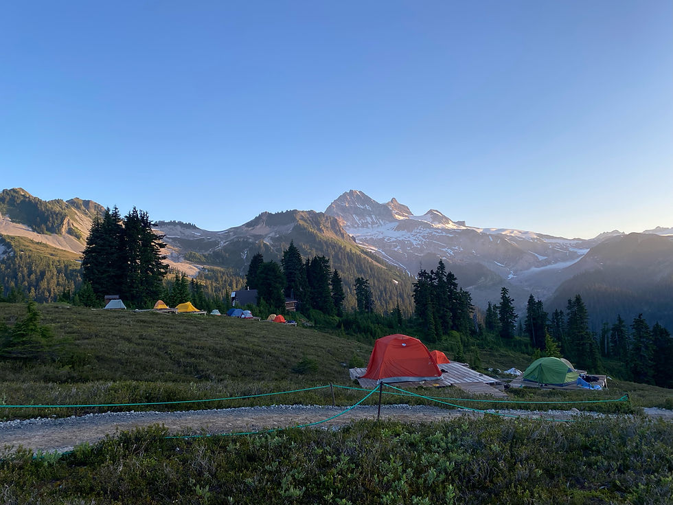
You will know you are close to the gondola when you see this sparkling pool of water they call "snowmaking reservoir":
What I brought:
Bug spray. I probably used about half the bottle plowing through the forest. The flies are RESILIENT.
Bear spray. Solo hikers need this in their bag at all times. I saw quite a few berry bushes in the forest and you know what that means.
Hydration pack. This is by far the best hiking investment I have made (aside from my hiking boots).
Portable charger. I kept the trail map open at all times, which killed my battery. This was a lifesaver.
TP. No outhouses at all until you get to Roundhouse Lodge.
High energy snacks.
Small ziploc bag to pack my garbage out.
Lip balm and eye drops. High elevation causes dryness.
Wet wipes.
Overall thought:
I have mixed feelings about this one. On one hand, I am super glad I explored the Interpretive Forest because it is such a big part of Whistler (even though it is technically part of Garibaldi) and I made it my mission to fully explore everything this place has to offer. I genuinely enjoyed how meditative it felt to be alone in the forest. No humans, no animals, no sounds, zero distractions. I even forgot about the bears for a bit.
On the other hand, it was dangerous and a huge risk because a) the path was meant for mountain biking, b) zero reception in some areas, and c) the paths are not marked and you have to rely on instincts to figure it out (even the trail map is not 100% accurate). If you are looking for some crazy forest adventure though, this is for you.
I could see myself doing this trail again but I would bring along two or three friends next time, just to be safe. This forest is massive and everything looks the same. It would be really hard to navigate out of it with no phone or map.


Comments