June 4th, 2023: Stawamus Chief
- Elaine
- Jun 4, 2023
- 6 min read
Updated: Oct 8, 2023
Type of hike: Loop | Time (approx): 4 hours and 30 minutes
Distance: Around 6.4km | Elevation Gain: 654m
What to expect:
1) It gets technical in some sections with ropes and chains
2) Popular trail to you won't be alone at all!
3) The first part is a stairmaster game
4) Shades throughout most of the trail except close to First Peak
Some important info:
1) No outhouses along the trail at all but there are a few at parking lot
2) Get there early as this is a popular trail and the parking lot fills up fast
3) Three peaks in total - First is most popular, Second one is even better IMO, nobody really goes to Third
What to bring:
1) Poles would be helpful if you are considering taking the Second/Third Peak Trail (lots of rocks and scrambles)
2) Bring some gloves if you wish to protect hands from metal rungs and chains
3) At least 3L of water, you will work up a huge sweat
4) First aid kit in case of injuries

The Hike
After failing to complete all three peaks back in 2020, I'm proud to say I finally hit all three of them this time around! Last time I wasn't able to find the second peak after hitting the first one, and ever since then, I've vowed to myself that one day I'll give it another shot and bag all three peaks. A lot of people hit the first peak and call it a day. Some say the second peak has the best views. Most don't venture all the way to the third peak. I wanted to see them all.
This is officially my first hike of the summer season - the weather in BC is getting warmer and sunnier as we head into June, so it's the perfect time. This trail is known locally as just "The Chief" and it is on just about every hiker's bucket list, including mine. Squamish is considered close by; it's only around 50 minutes by car from Downtown Vancouver. This trail is also incredibly popular, especially on the weekends, so don't expect to be lost in nature by yourself. I would suggest starting as early as possible in order to avoid the crowds - we started at 8am and the parking lot was already almost full. The sun was shining bright but luckily there was a bit of wind, so it wasn't too hot.
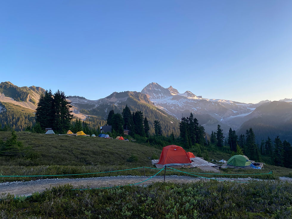
There is a campground nearby the parking lot, so the short path from the parking lot to past the campground is relatively flat and super easy. Makes one almost think the hike won't be that bad...until they get to the bottom of the stairs. I lost count of how many staircases there were but I want to estimate it to be around 6 or 8 of them. A lot of people say The Chief is a technical hike, but I like to call it a very man-made trail. Because there are not a lot of hikes out there that have wooden staircases, ladders, metal rungs and chains on their trails.
The steps on the staircases are decently high, higher than the steps on Grouse Grind. It's shorter than Grouse Grind though, so you just need to spent around 10 minutes huffing and puffing your way up them (depending on how fast you can do Stair Masters, of course) and then it's over. Then comes the part with stone steps, just like Grouse Grind. This part of the trail is easy to follow and is wide enough for people to pass or for those coming down, without you having to necessarily stop. Remember to look for the trail markers on the trees, sometimes they are hard to spot but generally they're visible.


The first peak is always the most crowded as this is the only peak most people attempt. There is an option to bypass this peak if you are interested in going to the second peak only, and the fork in the trail for this Second Peak Trail comes soon after Lookout Rock. If you continue all the way to the first peak and want to go to the second peak, there is a shortcut but that shortcut should only be attempted by people who have tried rock climbing before and are not afraid of heights. If you want to attempt it, you should check the map on AllTrails for this shortcut as it is not in plain sight. It kind of wraps around the giant boulder of the first peak, and for a few meters it is incredibly narrow. I thought we were walking on the wrong path because there is no way this could be a trail, but it was. This part is super short, and then it appears to come to an immediate stop, but that's where the hard part starts.
It looks like a dramatic fall, but actually you have to climb over this rock (that looks like it is going to send you rolling down the hill), and pick your way down using some jutting tree branches and other bits and pieces to hold on as you lower yourself down. Once we got down this part, there is a bit of flat road, but that relief didn't last long. We came up metal rungs that snaked down this First Peak's rock boulder so it was basically rock climbing but downwards. The rungs can be slippery when wet so be extremely careful, and be extremely careful of where your foot lands. I would suggest you don't follow anybody too closely just in case someone slips.
AllTrails have a warning for people attempting this shortcut from first peak and second peak - "the route from first peak to second peak as shown is actually a climbing route. Most of the second section of the hike are intense stairs and all elevation gain and the feared chains for the last quarter". So do be extra cautious!

Honest opinion - I didn't find the view from second peak that different than the first peak. They were both beautiful and scenic, but if you are hiking the trail solely for scenery, then I think you can stop at first peak. Unless you want the extra challenge, of course.
The route to the third peak is way easier and more straightforward. It doesn't have crazy elevation gains anymore, and mostly we just picked our way around trees and dirt and scattered rocks. It was refreshing after all the grueling work of hitting first and second peak. Look for the trail markers on the trees once again to guide your way.


The third peak's view is mostly of the trees and forests, so I can understand why people don't come to the third peak for views - there's really not too much to see. I loved it though, because it was more quiet and less busy than the other two. We found a ledge to sit on and have some snacks and we caught our breath and admired the calmness.
There is an option to come back down the exact same way we went up, but it was faster and also more interesting to try a new trail, which made this hike into a loop. We took the Second/Third Peak Trail down, and I was so grateful we did not come up this way. While there were markers, they were hard to spot, and even if you could see them, picking your way down was difficult because of all the giant rocks, loose dirt and fallen tree trunks and jutting roots left right and center that blocks your path...if there even is one. I overheard one person that was coming up this trail say "I don't know how we're going to find our way back down". The steep decline is really hard on the joints, so be prepared to be sore for a day or two afterwards.
My Thoughts:
It's very rewarding. Once I got past the first 30 - 40 minutes of steady and steep incline in the form of tall steps and rocks, it became fun with all the chains and metal rungs. The technicality part of it is what makes this trail unique and interesting, and honestly made the hike go by too fast. Of course, we had to be really careful because there are accidents that happen here, and one slip up can be dangerous or fatal, but my partner and I are physically active people so we were prepared for it. The first peak is beautiful but I would say if you are looking for a bit more of a challenge, the second peak will be well worth it. The third peak is for those who are looking for a bit of a longer hike, or if they want to be where there are less people.
Most of the trail is covered so it's not blistering hot on the skin. The few parts that are not covered are the peaks themselves. The trail is also incredibly manicured and easy to follow for the most part. Make sure your shoes have a good grip for climbing over giant rocks and boulders because theirs surface could be quite slippery. I didn't bring my hiking poles with me, but I don't think I needed them at all. Plus, having nothing to carry freed up my hands for the chains and rungs.


What a wonderful article. Chief is amazing spot!
Great captures! The Chief is always a fan favourite